If you’ve ever found yourself lost in the wilderness without GPS, you know just how daunting it can be. But fear not, because my blog, “The Survivalist Handbook,” is here to equip you with the navigation secrets you need to find your way in the great outdoors. From using natural landmarks and celestial bodies as guideposts to deciphering maps and compasses, I’ll show you how to navigate with confidence and precision. So whether you’re an experienced adventurer or a newbie to the wild, get ready to unlock the secrets of wilderness navigation and never feel lost again.

Understanding Navigation
Navigating in the wilderness is a crucial skill for any outdoor enthusiast. Being able to find your way without relying on GPS or electronic devices is not only empowering but also can be a lifesaver in certain situations. In this article, we will explore different techniques and methods of navigation to help you feel confident and prepared while exploring the great outdoors.
The Importance of Navigation
Understanding the importance of navigation cannot be overstated. Whether you are hiking, camping, or engaging in any outdoor activity, knowing where you are and how to get to your destination is essential for your safety. Navigation skills allow you to explore new areas, navigate through challenging terrains, and ultimately make it back home safely.
Types of Navigation
There are various types of navigation techniques that can be employed in the wilderness. These include map and compass navigation, celestial navigation, landmark and natural sign navigation, dead reckoning and pace count, and utilizing GPS. Each method has its advantages and limitations, and having a well-rounded understanding of these techniques will enhance your overall navigation skills.
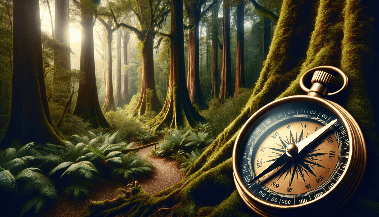
Map and Compass Basics
Map and compass navigation is a fundamental skill to master. Maps provide a visual representation of the land, including topography, trails, landmarks, and more. Understanding how to read and interpret maps is the foundation for successful navigation. Compasses, on the other hand, help determine direction, bearing, and azimuth. By combining map reading with compass skills, you can accurately navigate through any terrain.
Using Natural Signs and Landmarks
Nature provides us with an abundance of signs and landmarks that can aid in navigation. By observing the environment around you, you can identify natural signs such as the direction of the sun, growth patterns of vegetation, prevailing winds, and animal tracks. Additionally, recognizing and using landmarks like mountains, rivers, or distinctive rock formations can help you establish a mental map and navigate more effectively.
Mastering Map Reading
Choosing the Right Map
When it comes to map reading, choosing the right map is vital. Different regions and activities require specific maps that provide the necessary details for navigation. Topographic maps, for example, contain contour lines, which depict the elevations of the land. These maps are particularly useful for navigating through mountainous or hilly terrains. It is essential to familiarize yourself with the different types of maps available and select the most appropriate one for your adventure.
Understanding Map Symbols
Maps are filled with symbols that represent various features of the land. To effectively navigate using a map, you must understand and interpret these symbols. Symbols can indicate anything from trails and roads to water bodies, campsites, and boundaries. By knowing what these symbols mean, you can accurately identify your location and plan your navigation routes accordingly.
Orienting the Map
Orienting the map means aligning it with the actual terrain and the direction you are facing. By orienting the map, you can accurately determine your position and the direction to your destination. One common technique for orienting the map is using a compass. By aligning the map’s north-south gridlines with the compass needle, you can ensure that the map is correctly oriented.
Measuring Distances on a Map
Measuring distances on a map is essential for planning your route and estimating the time it will take to reach your destination. Maps often have scales that allow you to convert the distances on the map to real-world measurements. By using a ruler or your compass, you can measure the distance between two points on the map and calculate the corresponding distance in real life. This skill is particularly useful for pacing yourself during long hikes and estimating the time it will take to reach landmarks or campsites.
Navigating with a Compass
Compass Components and Functions
To effectively navigate with a compass, it is crucial to understand its components and functions. Compasses typically consist of a baseplate, a rotating bezel, a magnetic needle, and a directional arrow. These components work together to help you determine your direction and navigate accurately. Familiarizing yourself with how each component functions will greatly enhance your compass navigation skills.
Taking a Bearing
Taking a bearing refers to determining the direction of a specific point or landmark from your current location. By placing the compass on the map and aligning it with your position and the desired target, you can read the magnetic heading at the edge of the compass. This reading represents the bearing you need to follow to reach your destination. Taking accurate bearings is essential for successful navigation between points, especially in featureless terrains or dense forests.
Following a Bearing
Once you have determined the correct bearing using your compass, it is crucial to be able to follow that bearing accurately. To do this, hold the compass level, with the direction of travel arrow pointing towards your destination. Rotate your body until the magnetic needle aligns with the orienting arrow. Finally, navigate in the direction of travel indicated by the direction of travel arrow. Constantly checking your compass and staying true to your bearing will ensure you stay on track.
Using Triangulation
Triangulation is a technique used to determine your exact location by using multiple known landmarks or points. By taking bearings on at least two visible landmarks and plotting them on your map, you can find the intersection point where the bearings meet. This intersection represents your approximate location. Utilizing triangulation can be extremely helpful when navigating in areas with multiple landmarks or in situations where visibility is limited.
Using Celestial Navigation
Understanding Celestial Bodies
Celestial navigation relies on using celestial bodies, such as the sun, stars, moon, and planets, to determine direction and time. Understanding how these celestial bodies move across the sky and their positioning at different times can provide valuable information for navigation. Learning how to identify and track these celestial bodies will greatly enhance your ability to navigate without relying on other tools or devices.
Finding Direction Using the Sun
The sun is one of the most accessible celestial bodies for navigation. By observing the movement of the sun and its position in the sky, you can determine the cardinal directions. The sun rises in the east and sets in the west, and at noon, it reaches its highest point in the sky, which is due south in the northern hemisphere and due north in the southern hemisphere. By taking note of the sun’s position and time, you can identify the approximate direction you need to travel.
Navigating at Night with the Stars
Stargazing can be more than just a hobby; it can also be a valuable navigation tool. The stars provide a fixed reference point in the night sky, allowing you to determine direction. By identifying specific constellations or stars, such as the North Star (Polaris), you can find your bearings. Different constellations also change their position throughout the night, helping you track the passage of time and ensure you stay on course.
Using the Moon and Planets for Guidance
In addition to stars, the moon and other planets can also be used for navigation. The moon’s position and phase can help determine direction and time, while bright planets, such as Venus or Mars, can act as reference points in the night sky. By understanding the movement patterns and positions of these celestial bodies, you can accurately navigate even when surrounded by darkness.

Navigating by Landmarks and Natural Signs
Identifying and Using Landmarks
Landmarks are prominent features in the environment that can aid in navigation. They can be anything from mountains and rivers to distinctive rock formations or man-made structures. By identifying and memorizing key landmarks along your route, you can create mental maps that guide you through the wilderness. Landmarks serve as reference points, allowing you to track your progress and ensure you’re heading in the right direction.
Recognizing Natural Signs in the Wilderness
Nature provides us with countless signs and clues that can help us navigate effectively. By observing the environment around you, you can identify natural signs such as the direction of the wind, the growth patterns of vegetation, and the behavior of animals. For example, moss tends to grow more abundantly on the northern side of trees, indicating a northward direction. These natural signs act as subtle indicators that can guide your way, especially in areas devoid of prominent landmarks.
Creating Mental Maps
Creating a mental map is an essential skill for efficient navigation. By constantly observing and taking note of key features and landmarks, you can construct a mental picture of the terrain around you. This mental map helps you stay oriented and navigate accurately without solely relying on physical maps or compasses. By combining your observations with your understanding of map reading and compass navigation, you can confidently explore and navigate through unfamiliar areas.
Trailblazing Techniques
In situations where trails or established routes are not available, trailblazing techniques become invaluable. Trailblazing involves creating your own path through uncharted territory. By using a combination of natural signs, map reading skills, and compass navigation, you can navigate safely through dense forests or overgrown vegetation. This technique requires careful observation and planning to ensure you can retrace your steps and make your way back.
Dead Reckoning and Pace Count
Utilizing Dead Reckoning
Dead reckoning is a technique that involves estimating your current location based on the distance traveled and the direction taken from a known starting point. By keeping track of the distance traveled and the direction followed, you can plot your approximate position on a map. Dead reckoning is particularly useful when navigating over long distances without prominent landmarks or in situations where visibility is limited.
Determining Pace Count
Pace count refers to the number of steps it takes you to travel a particular distance. By determining your pace count, you can estimate the distance covered during your journey. To determine your pace count, measure a known distance (such as 100 meters) and count the number of steps it takes you to cover that distance. By averaging your pace count over various terrains and conditions, you can develop a reliable estimate for measuring distances during navigation.
Measuring Distance with Pace Count
Once you have determined your pace count, you can efficiently measure distances while navigating. By counting your steps for a specific distance, you can easily calculate the corresponding distance on your map or estimate the distance to a nearby landmark. This technique is particularly useful when visibility is limited, and relying on standard map measurements is challenging.
Compensating for Varied Terrain
Terrain plays a significant role in navigation, and it is essential to account for the challenges it presents. Different terrains, such as uphill slopes, downhill descents, or rough terrain, can affect your pace count and the distance covered. When navigating through varied terrain, it is important to adjust your pace count accordingly to ensure accurate measurements and precise navigation.
Understanding GPS Limitations
Battery Life and Reliability
While GPS devices can be a valuable tool, it is important to understand their limitations. One of the primary concerns with GPS is battery life. Depending solely on electronic devices for navigation means risking the battery dying before completing your journey. Additionally, GPS devices can sometimes experience technical malfunctions or signal issues, which can decrease their reliability.
Signal Interference and Loss
GPS signals can be affected by various factors, including dense foliage, tall buildings, or canyons. In these situations, the signal can become weak or even lost entirely, rendering the GPS device ineffective. It is crucial to have a backup navigation method, such as map and compass navigation, when faced with signal interference or loss.
Outdated Maps and Data
GPS devices rely on accurate and up-to-date maps and data. However, it is important to note that maps and data can become outdated over time due to changes in the landscape, trails, or other environmental factors. Relying solely on GPS without cross-referencing with physical maps or other navigation techniques can lead to potential errors or inaccurate information.
Dependency and Complacency
Finally, relying too heavily on GPS can lead to dependency and complacency. It is important to continuously practice and improve your navigation skills to avoid becoming overly reliant on electronic devices. Being able to navigate effectively using traditional methods ensures that you can still find your way in case of GPS failure or unavailability.
Developing Situational Awareness
Observing Surroundings and Changes
Developing situational awareness is key to staying safe and navigating effectively in the wilderness. Actively observing your surroundings and being aware of any changes can provide valuable information for navigation. Pay attention to landmarks, natural signs, weather conditions, and any other factors that may impact your journey.
Noticing Terrain and Vegetation
Terrain and vegetation can significantly impact navigation and route planning. By paying attention to changes in terrain, such as steep ascents or descents, rocky areas, or open fields, you can better anticipate and adjust your navigation strategies. Additionally, being aware of vegetation patterns and types can help you identify different environments and navigate accordingly.
Tracking Time and Direction
Keeping track of time and direction is crucial for successful navigation. By regularly checking the time, you can estimate the distance traveled and plan your journey accordingly. Additionally, constantly checking your direction using tools like a compass or natural signs will help you stay on track and prevent getting lost.
Utilizing Topographic Features
Topographic features, such as ridges, valleys, or water bodies, provide valuable information for navigation. By identifying these features on your map and correlating them with your surroundings, you can better visualize the terrain and plan your route. Topographic maps are particularly useful for understanding these features and navigating through complex terrains.
Navigating in Challenging Environments
Navigating in Dense Forests
Navigating in dense forests presents unique challenges due to limited visibility and obstacles like thick vegetation. In such environments, relying on a combination of trailblazing techniques, dead reckoning, and constant observation of natural signs becomes crucial. Being aware of noise levels, wind direction, or any clearing in the vegetation will aid in navigation and help you find your way out of the forest.
Finding Your Way in Mountains
Mountainous terrains can be both breathtaking and intimidating. Navigating in mountains requires a strong understanding of topographic maps, compass navigation, and terrain analysis. By identifying prominent features, understanding elevation changes, and accurately determining your location, you can successfully navigate through mountainous areas and reach your destination safely.
Navigating Across Open Water
Navigating across open water presents a unique set of challenges. Without prominent landmarks, it becomes crucial to rely on compass navigation, celestial navigation, and dead reckoning to ensure you reach your desired destination. Understanding tides, currents, and wind patterns is also essential in successfully navigating open water.
Survival Navigation in Extreme Conditions
Survival navigation in extreme conditions, such as harsh weather or challenging terrains, requires a combination of various navigation techniques and adaptability. By utilizing your navigational skills, staying calm, and making calculated decisions, you can navigate through extreme environments and increase your chances of survival.
Building Your Navigation Skills
Practice, Practice, Practice
The key to becoming a proficient navigator is practice. Set aside time for regular navigation exercises and familiarize yourself with different techniques and tools. Practice using maps, compasses, and natural signs in various environments to build confidence and gain experience. The more you practice, the more comfortable and proficient you will become in navigating the wilderness.
Participating in Orienteering Events
Orienteering events provide an excellent opportunity to apply your navigation skills in a competitive and controlled environment. By participating in orienteering events, you can challenge yourself, learn from experienced navigators, and gain valuable insights into different navigation strategies. These events often offer different levels of difficulty, allowing you to progress and improve your skills over time.
Taking Navigation Courses
If you are new to navigation or want to refine your skills, consider taking navigation courses. These courses provide structured instruction from experienced navigators and cover various aspects of navigation, from map reading to compass techniques. By learning from experts in the field, you can accelerate your learning and gain valuable insights into advanced navigation techniques.
Learning from Experienced Outdoorsmen
One of the best ways to improve your navigation skills is to learn from experienced outdoorsmen or women. Seek guidance from seasoned hikers, campers, or adventurers who have navigated through different terrains and environments. Their firsthand experiences and tips can provide invaluable knowledge and instill confidence in your own navigation abilities.
In conclusion, mastering navigation skills is crucial for anyone venturing into the wilderness. By understanding different navigation techniques, such as map and compass navigation, celestial navigation, and using natural signs and landmarks, you can confidently explore the great outdoors and ensure your safety. Developing situational awareness, practicing regularly, and continuously learning from experts will enhance your navigation skills and make every wilderness adventure a success. So embrace the art of navigation and get ready to find your way without relying on GPS in the wilderness!